Landscape and Visual Impact Assessment
We undertake Landscape and Visual Impact Assessments at different levels to support planning applications.
All work is produced in line with current and best practice guidance, including IEMMA’s Guidelines for Landscape and Visual Impact Assessment. We agree our methodology and viewpoint locations with the relevant Planning Authority.
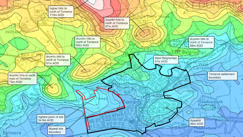
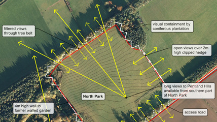
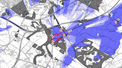
We produce all our graphics in-house, including Zone of Theoretical Visibility (ZTV) mapping, viewpoint photography and photomontages. This ensures a continuous thinking and a confidence in the materials being used to carry out the assessments.
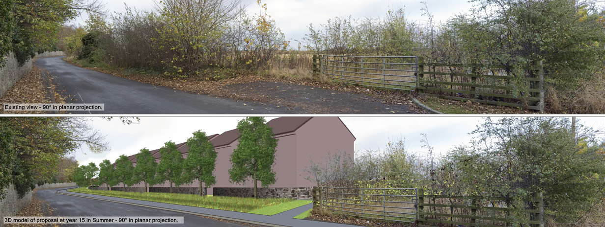
Our photomontages are catered towards the proposal at its current stage. For instance, we generally prepare simple block models of homes for Planning Permission in Principle applications and more detailed models for a Planning Permission application.
- Demonstration of the acceptability of the proposals in terms of landscape and visual impact.
- Informs the type and extent of landscape and visual mitigation required as part of the proposals.
- Verifiable photomontage visualisations demonstrating how the proposals will be viewed within the existing landscape.